Cinematic Reality-Capture

Turn Real Locations Into Production-Ready Digital Assets

Sonic 4, LiDAR + Photogrammetry 2025

Why Aerial Reality-Capture

Flying Monster bridges the gap between cinematic aerial capture and survey-grade scanning.


We rapidly capture entire sets', streets, terrain, structures, and complex environments from the air — delivering clean datasets optimized for VFX, previs, and digital twin workflows.

  • Massive environments captured in hours, not days
  • Real-time on-site verification for quality control
  • Designed specifically for film, TV, and virtual production
Book Service

Aerial Payload Options


Drone + L3 LiDAR

High-density aerial laser scanning produces accurate geometry across complex environments — from dense urban streets to natural terrain.

Drone + P1 Photogrammetry Sensor

Ultra-high-resolution 48MP global shutter RAW imagery captures texture detail and lighting reference that translates cleanly into VFX pipelines.

John Wick 3 / Aura VFX Studio Capture

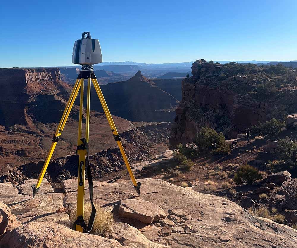
Terrestrial LiDAR — Powered by Aura VFX

Flying Monster has partnered with Aura to provide millimeter-accurate terrestrial scanning using the Leica RTC360 platform. This ground-based LiDAR captures ultra-dense geometry for interiors, hero assets, and fine architectural detail — complementing our large-scale aerial LiDAR datasets.

  • Seamless integration with aerial LiDAR workflows
  • Rapid high-density scanning
  • Designed specifically for film, TV, and virtual production
LEICA SCAN SPECS

On-Set Processing. Same-Day Assets.

Traditional reality-capture workflows often take weeks — sometimes months — before production even knows if the data is usable. Flying Monster changes that timeline completely.


Our team processes LiDAR and photogrammetry directly on location, turning raw capture into verified digital assets the same day. Instead of waiting for off-site pipelines, production can immediately review coverage, scale, and geometry while we’re still in the field.

  • Immediate mesh previews and dataset validation
  • Verify accuracy before leaving location
  • Eliminate costly re-captures and schedule delays
  • Faster handoff to VFX, previs, and virtual production
  1. Project Planning
    We learn your goals and design the capture.

    You tell us what you need scanned — a film location, set build, environment, or structure. Our team plans exactly how the drones will fly to capture the best possible data quickly and safely.

    What we handle:
    - Scan planning and coverage design
    - Safety planning
    - Automated drone flight paths
    You don’t need any technical experience, we guide you through it.

  2. Permits & Approvals
    We take care of the paperwork.

    Drone operations often require FAA approvals or location permissions. Our team manages the process so production doesn’t have to worry about regulations.

    What we handle:
    - FAA authorizations and waivers
    - NYPD drone application
    - Local coordination
    - Production safety documentation

  3. On-Location Capture
    We arrive and scan the environment.

    Our crew deploys aerial LiDAR and photogrammetry drones to capture your location quickly — often covering large areas in a single day.

    What you’ll see:
    - A small, efficient crew
    - Automated drone flights
    - Minimal disruption to production

  4. On-Set Processing
    We process the data while we’re still there.

    Traditional reality capture companies leave the location and take weeks or months to deliver results. Flying Monster processes data on site the same day, allowing us to confirm everything is accurate before we leave.

    Why this matters:
    - No guessing if the data worked
    - No surprise gaps later
    - No expensive re-capture days

  5. Fast Asset Delivery
    You receive digital assets ready for VFX and virtual production.

    Once capture is complete, we organize and deliver clean datasets your team can immediately use.

    Typical deliverables:
    - LiDAR point clouds
    - Textured 3D meshes
    - Photogrammetry models
    - Production-ready project files
    - Raw image capture

“Flying Monster changed the pace of our LiDAR workflows. Their aerial capture allowed us to scan environments at a scale that would normally take multiple ground teams days to complete. The data quality was production-ready, and their real-time validation meant we left the location confident we had everything we needed. For modern VFX pipelines, this approach is a major step forward.”


- John Ashby, Senior VFX LiDAR Supervisor